After the Ao Tai hiking trail became a viral sensation, there are no longer any accessible outdoor activity spots in the Qinling Mountains.
Starting from Fengyu Pass of the Qinling Mountains, about 25 kilometers away from the urban area of Xi'an, driving along the mountain road of National Highway 210 for about an hour, you can reach Jiwuozi Village. Starting to climb the mountain from here, you can reach the top of Guangtou Mountain after a climb of more than 1,000 meters. The mountain has an altitude of 2,886 meters. After reaching the summit, there is an open alpine meadow, overlooking the rolling Qinling Mountains. With good luck, you can also encounter the sea of clouds and the sunset.
Before the Aotai Route became a smash hit, this was one of the most famous hiking routes in the Qinling Mountains, the "Dasi Route". The most representative spot is the Stone Family of Dasi, a farmhouse deep in the mountains, which has long been used as a resting place by hikers. The adobe exterior walls were once covered with dense flags — "Xi'an Hikers Club", "Molu Outdoor", "007 Outdoor", "Xi'an Pioneer Outdoor", "Xingzhe Fengleyou Club".
But now, all the flags on the wall have disappeared, leaving only a few chalk words: "The mountain is closed, climbing is prohibited".
Shen Hui told Lanxiong Sports that probably in the summer of 2025, this farmhouse was closed, and all the routes up the mountain from Jiwuozi Village were also blocked. Now the area there is "managed more strictly than the border".
Shen Hui used to be a leader of an outdoor club in Xi'an, and he entered the industry eight years ago out of his love for outdoor activities. However, as the relevant authorities have tightened the control over outdoor activities in the Qinling Mountains, the operation of the club has become increasingly difficult. At the beginning of this year, he decided to change his career and now works as an online car-hailing driver in Xi'an. The outdoor club he once worked for has also been disbanded.
At the end of 2025, many Shaanxi hikers sighed on social media that "there is no outdoor activity left in the Qinling Mountains", and many people took photos of the local authorities pulling barbed wire on the wild mountain roads. Now there are fewer and fewer mountains available for climbing here. They miss the scenery they once could see on this "Chinese Dragon Vein", and worry that such scenery will become a one-of-a-kind sight that can never be seen again.
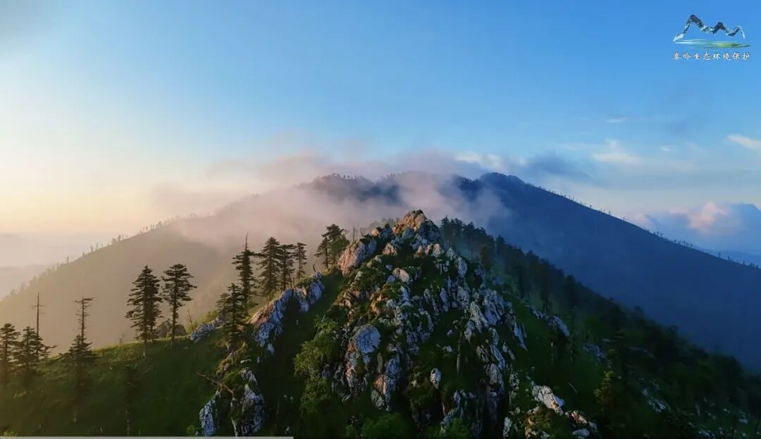
▲ Guangtou Mountain of Qinling Mountains Source: Screenshot from the video of the WeChat official account of Qinling Ecological Environment Protection
01
Unstoppable Illegal Crossing
At the two sessions held earlier this year, Gong Fuwen, a member of the National Committee of the Chinese People's Political Consultative Conference from Shaanxi, put forward a proposal titled "Scientifically Delimiting Legal Hiking Routes in the Qinling Mountains to Build an Outdoor Management System Combining Dredging and Blocking". He paid attention to the contradiction between the strong public demand for outdoor sports and the ecological protection of the Qinling Mountains, and believed that solutions could be provided by delimiting legal hiking routes and adopting the "combination of dredging and blocking" approach.
This call got a clear response in mid-October. The Shaanxi Provincial Bureau of Sports released the "First Batch of Open Outdoor Mountaineering and Hiking Routes in the Qinling Mountains", selecting three routes: Dayu, Xiaoyu and Baidaoyu. According to the reply letter from the People's Government of Shaanxi Province, these three mountaineering routes "have a long history of public mountaineering, concentrated daily hiking passenger flow, and the overall altitude is suitable for the public to travel".

The one-way distances of the three routes are 5.7 km, 6.1 km and 3.9 km respectively, and the whole round trip does not exceed 8 hours. Starting from different valley passes, they all lead to the same destination, the Mountain God Temple. This area is better known among hikers as the "Jiaowutai Route". In the "snobbery chain" of outdoor enthusiasts, it is a regular entry-level route. You can start from different entrances. The mountain has wild roads different from scenic spots, without over-development, and you can feel the fun of mountaineering challenges.
The most important reason for delimiting an official hiking route is that the crossing of the "Aotai Route" has been repeatedly prohibited but never stopped.
This hiking route, which has frequently appeared in social news in recent years, is located between the two main peaks of the Qinling Mountains, Aoshan Mountain and Taibai Mountain. The straight-line distance is about 40 kilometers, and hikers need to continuously cross 17 peaks with an altitude of more than 3,400 meters. It is known as the hiking route with the highest mortality rate in China due to frequent extreme weather and difficult rescue.
This route is also located in the national nature reserve. The above reply letter mentioned that the area of the ecological protection red line within the Qinling Nature Reserve delimited by Shaanxi Province is about 39.8591 million mu (about 26,600 square kilometers). In principle, human activities are prohibited in the core reserve, and only activities such as ecological restoration, scientific research, monitoring and observation are allowed.
According to the "Regulations on Ecological Protection of the Qinling Mountains of Shaanxi Province", within the scope of the Qinling Mountains, except for the urban development boundary determined by the territorial space planning, the areas with an altitude of more than 2,000 meters, the areas within 1,000 meters on both sides of the main ridge of the Qinling Mountains system, and the areas within 500 meters on both sides of the main branches all belong to the core reserve of the Qinling Mountains.
"Getting stricter and stricter" is the common feeling of outdoor practitioners in the Qinling Mountains. In 2018, Mei County and Taibai County of Shaanxi Province issued a joint announcement, comprehensively prohibiting any unit or individual from entering at will to carry out illegal crossing activities on the Aotai Route. In the eyes of outdoor enthusiasts, this is equivalent to defining the nature of this famous hiking route. However, given the great reputation of the Aotai Route, after it was defined as illegal crossing, there are still an endless stream of people coming to challenge it. Shen Hui told Lanxiong Sports: "Before the epidemic in 2019, the top of the mountain was as crowded as a market, there were so many people, and tents could be pitched anywhere."
The epidemic has significantly promoted the development of domestic outdoor sports. According to the monitoring data of the Taibai Mountain Reserve Administration, from 2018 to 2022, 3,119 people still appeared on this route. But the real catalyst did not come until the summer of 2024, when the Aotai Route became a hit on video websites.
The outdoor blogger "Mengshe Guojiang" released multiple videos of cycling across the Aotai Route, in which black bears could be seen, and once a corpse was found in a roadside tent. He was later punished for his crossing behavior.
Another local outdoor club leader in Shaanxi recalled that after that, the control of the mountain access routes began to become stricter. The local government began to install barbed wire and cameras at the entrances. If someone was detected approaching, a broadcast would be used to remind them. These places surrounded by barbed wire are not only the core reserves, some mountains not in the core reserves have also been closed.
Shen Hui recalled that starting from 2024, mountain patrols would be carried out from time to time, but for some hikers, the control was not so strict at that time, and they still tried every means to go up the mountain.
Earlier this year, another casualty accident occurred on the Aotai Route. In the early morning of January 2, 5 people avoided the management station and illegally crossed the "Xiao Aotai Route", and 3 people unfortunately died. Shen Hui speculated that the 5 people turned off their mobile phones to avoid being tracked by mobile phone signal control for crossing behavior, so they missed the best rescue time.
After this incident, the control of the mountain entrances in the Qinling Mountains was upgraded to the strongest level ever. Almost all mountaineering entrances are equipped with prefabricated houses, guarded 24 hours a day, and there are dogs at the door. As long as someone moves, the dogs will bark, and then the forestry bureau staff will rush out collectively to stop people trying to climb the mountain.
02
Outdoor Clubs Can Hardly Sustain Operations
The above leader told Lanxiong Sports that after the control was strengthened, 3/5 of the routes he used to lead teams on can no longer be used. The remaining 2/5 of the routes are basically at the "kindergarten" level of difficulty. The role of outdoor clubs is "to put it bluntly, to cook the food at the foot of the mountain and bring it up to reheat". Also because the routes are too simple, fewer and fewer people sign up for group tours. Hikers can roughly search for the routes online, find a few partners and climb up the mountain by themselves.
Shen Hui calculated that "in the past, we could organize three or four groups a week, and almost 10 people could be gathered each time. Now we can't even gather enough people for one group a week."
The Guangtou Mountain, Lujiao Liang, Paoma Liang, Bmaying and Bingjingling in the Qinling Mountains together form the "Guang-Lu-Pao-Bing-Bing" hiking crossing route. Before 2018, this was also a route that outdoor clubs often took.
The highest altitude of these routes is more than 2,000 meters. Starting from the foot of the mountain, the one-way distance is more than 10 kilometers, and the whole journey is more than 20 kilometers. In the early years, if you wanted to hike a route like Lujiao Liang with a group, the fee ranged from 130 to 160 yuan, excluding meals, and the leader could provide cookware to boil water.
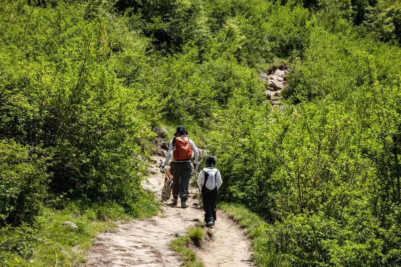
Now these high-altitude routes can no longer be organized. After the "mountain closure", the number of participants in outdoor clubs has dropped significantly, and many low-altitude single routes can also be completed without joining a club.
The club where the above leader works has very few routes left, with a total length of about 10 kilometers. The most difficult route has a total length of 19 kilometers and a maximum altitude of 1,100 meters. The price of these routes is uniformly 90 yuan. This price is not low, and some outdoor clubs can even lower it to 70 yuan, but such a price can no longer make ends meet. Taking his club as an example, in the early years, the price for a single person to join a group was only around 120 yuan, but there were many sign-ups, and six or seven activities could be organized a week, with at least 200 people in total. This year, the number of people is less than half of the previous number. There are many clubs like theirs, and many founders and leaders have changed their careers.
03
Blocking or Dredging
The management of outdoor wild routes (undeveloped and open routes, illegal crossing, private climbing of unopened peaks, etc.) across the country is scattered in the "Regulations of the People's Republic of China on Nature Reserves", local special regulations and paid rescue mechanisms. There are hundreds of national nature reserves in China. In principle, ordinary people are prohibited from entering the core reserves, and tourism development is absolutely not allowed. However, some places carry out a small amount of ecotourism and popular science plank roads in the experimental area/general control area outside the core reserve.
About ten years ago, Shaanxi also considered opening up such routes. After an accident on the Aotai Route in 2017 that trapped more than 40 people and killed 3 people, the Chinese Mountaineering Association and the Mountaineering Management Center of the General Administration of Sport of China tried to compile a safety specification manual for the Aotai Route. But according to Chen Zheng, chairman of the Shaanxi Mountaineering Association, in an interview with China Newsweek, the General Administration of Sport of China and the Shaanxi Provincial Bureau of Sports jointly held a symposium at that time, but the Shaanxi Provincial Forestry Bureau stopped the release of the manual on the spot, emphasizing that crossing the Aotai Route is illegal.
Earlier than that, in 1994, the Taibai Mountain National Nature Reserve Administration once designated an "experimental area" in the Taibai Mountain Nature Reserve, built an ecotourism community, and designed the old road that people had taken for mountaineering and praying for blessings since ancient times into 3 routes leading to the highest peak Baxian Tai. After the protection of the Qinling Mountains was upgraded in 2021, these routes were gradually shut down because they did not comply with the current laws and policies.
The Taibai Mountain National Forest Park is a national 5A-level scenic spot. Before 2023, tourists could take a cable car to "Tianyuan Difang" and then walk to Baxian Tai, the main peak of Taibai Mountain, for a journey of about 8 kilometers. But now the road to Baxian Tai has been closed for more than three years.
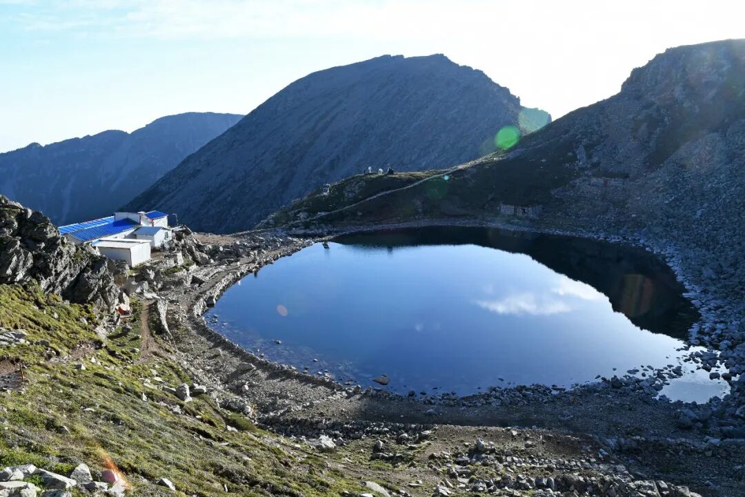
▲ Daye Hai of Taibai Mountain
As a major mountaineering province, Sichuan also has unique outdoor conditions, high mountains that are no more than 100 kilometers away from the megacities with a population of 10 million in straight-line distance, and is also a paradise for outdoor enthusiasts. Sichuan Province is also thinking about how to develop the outdoor industry while ensuring safety. In the famous Siguniang Mountain Scenic Area, many outdoor activities such as hiking, ice climbing, rock climbing, mountaineering, camping, cross-country running can be carried out at present, such as the classic Changbi Crossing hiking route. The matching current regulation is that all outdoor activities require mandatory hiring of certified mountain guides and registration for the record.
A local outdoor photography blogger in Shaanxi wrote that short videos are the reason for the change from dredging to blocking. Before the rise of short videos, the scope of activities for hikers was usually wild mountains with high risks and great difficulty, and the people who could carry out mountaineering activities were destined to be a small group. "When outdoor activities are controlled in a small scope, the impact on society and the environment is tiny and can be ignored, which will not lead to strict management. But when short videos spread this niche sport into a mass activity that everyone can participate in, problems arise. The scope of influence expands, and strict management is inevitable."
The "Regulations on the Ecological Environment Protection of the Qinling Mountains" was introduced in 2007. In the first ten years, it did not carry out strict intervention, but adopted a gentle educational guidance approach. At that time, accidents were mainly concentrated on the Aotai Route. In recent years, the public with relatively little outdoor experience began to enter the mountains, and the accident risk has surged. Many routes that were previously considered mature and not very difficult also frequently had accidents, which led to the heavy-handed rectification of illegal crossing.
After hearing the news that Shaanxi Province has formulated official outdoor mountaineering routes, outdoor practitioners also expect this to be a transformation from "blocking" to "dredging".
However,