Google messed up Google Earth by forcibly integrating AI features, and the service crashed in less than two days.
For anyone, the most intuitive way to know where a place in the world is and what it looks like is to check it on a map.
Decades ago, people relied on huge paper maps. Google Earth has spent over 20 years getting users accustomed to digital maps — and then it made a huge misstep last week.
Non-existent content started appearing on the map
Using digital technology to explore the world was one of the features that made Google Earth a stunning hit when it first launched. I still remember when I was a kid, sitting in front of the computer, typing in a vague place name "France, Paris, Fontainebleau..." and hitting enter, a deep blue planet would spin and zoom in suddenly, and in a blink I found myself surrounded by ancient French-style buildings and gardens.
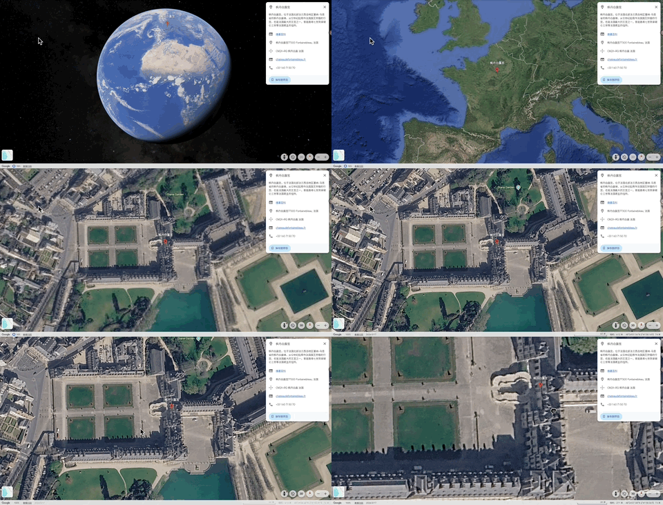
It was only when I grew up that I had to face how much money and time it would cost to visit Fontainebleau. What Google Earth provides is an instant response to people's curiosity about the real world. When conditions are limited, a little proxy satisfaction is not a bad thing — at least I immediately learned that Fontainebleau is not located in Paris, but further north in France.
Last week, Google announced that it had integrated Nano Banana 2 into the web version of Google Earth. Users only need to find any location on Earth, click "Generate Image", and enter a sentence, then the AI will use the local real satellite, aerial and 3D imagery as the base map to generate a new image that looks perfectly consistent with reality.
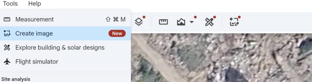
Google has envisioned very decent use cases for this feature: converting an empty lot into a community garden, recreating the city of Pompeii from the Roman era, previewing residential and commercial streets that have not yet started construction, or seeing what a city will look like a hundred years from now. The official calls these images "concepts rooted in the real world", which is the pro max upgraded version of the "world exploration" experience we had in childhood.
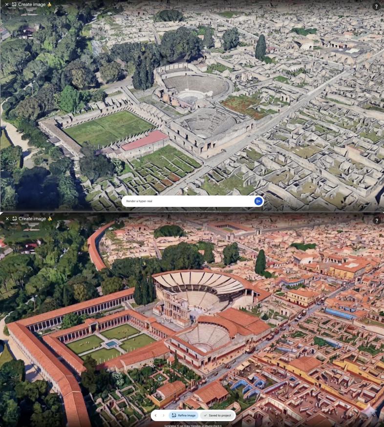
The image above shows the current state of Pompeii, and the image below shows the restored effect achieved via Nano Banana. Image source: Google Earth Technical Blog
Product managers are often like this: their ideas sound great, sometimes even too good to be true. After the feature went live, "rooted in the real world" immediately turned into something else: edited images that are almost impossible for people to doubt.
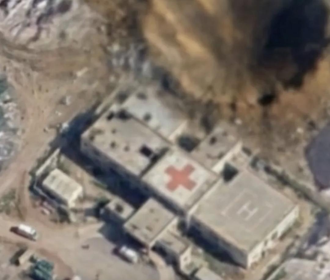
Investigative journalist Henk van Ess used a single sentence to generate a non-existent nuclear power plant, created a refugee camp on the border, staged a fatal car accident on the streets of Amsterdam, and blew up a crater next to a field hospital.
BBC Verify also conducted tests, generating images of the collapsed Eiffel Tower, a giant sinkhole swallowing the Giza Pyramids, and many other scenarios.
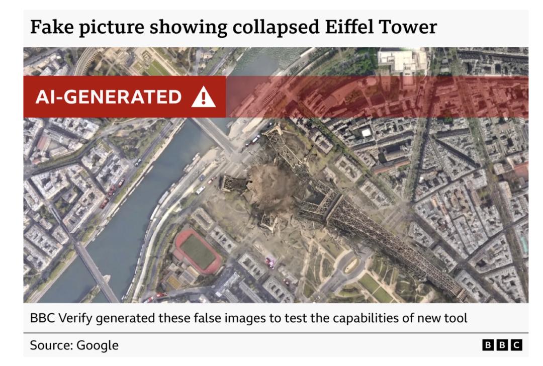
Obviously, the Eiffel Tower is still intact now, and none of the incidents mentioned above have happened. But these generated images inherit the coordinates, landforms, architectural proportions, lighting and overhead shooting angles of real locations. More importantly, they inherit the credibility that Google Earth has built in users' minds over the years.
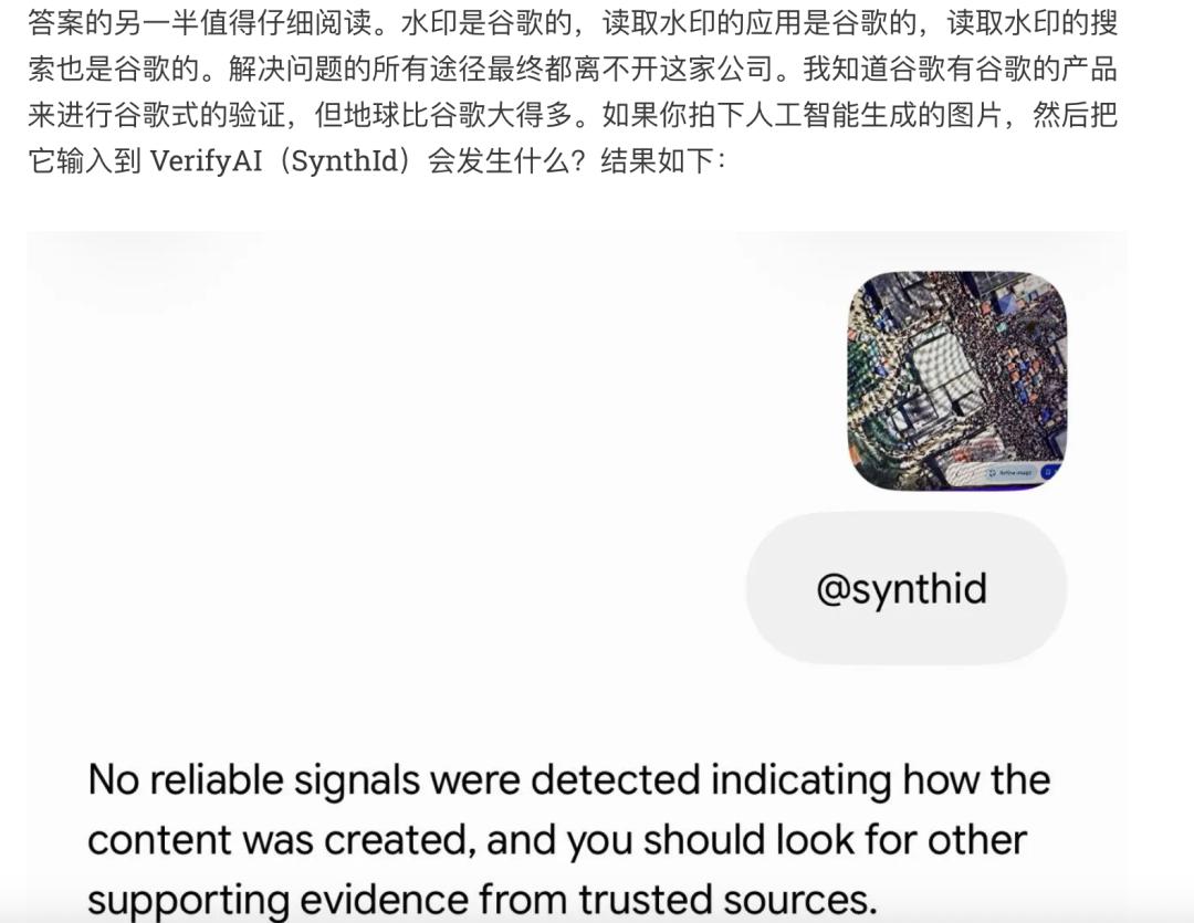
Google's initial response stated that the generated images are embedded with SynthID digital watermarks, and users can check whether an image is AI-generated via Gemini or Google Lens, and the system will also block harmful content. However, testers found that some dangerous prompts were not intercepted, and slightly rephrasing the prompts could bypass the restrictions; once the image is screenshotted, cropped or reposted, ordinary users will not take the initiative to go through Google's verification process. Even if the image is sent to detection software, no valid check result can be obtained.
Less than two days after launch, the feature was withdrawn. Google posted on social media that "we know people place extraordinary trust in the reliable view of the world that Google Earth provides", and they have already seen people share generated images that appear to violate policies, so they will make further plans after adding stricter protection measures.
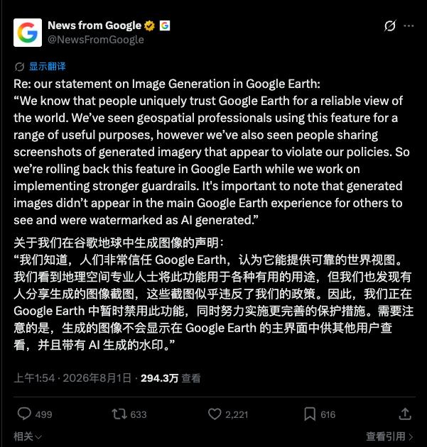
This exposes the strangest part of the whole incident: If Google knows why people trust Google Earth, how could it launch a feature designed for fictional content in the product?
The most important thing for a map is not imagination
The status of Google Maps comes from its design logic: it will not blur satellite images on its own initiative. Only when the government or property owner submits a request and the application is approved, will certain locations be blurred. Therefore, originally if you wanted to remove a real building from Google Earth, you needed an official letter from the government.
But now, to add a nuclear power plant in a city, you only need one sentence.
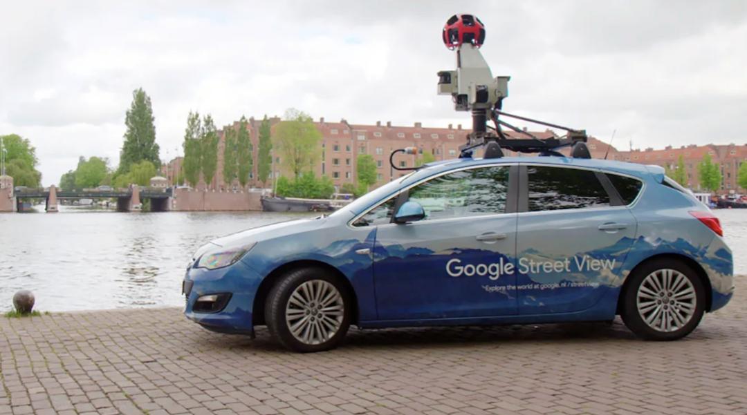
Of course Nano Banana can generate the above images. Technically, this is even a fairly natural extension. Google owns the world's largest geographic image library. According to Google's own statement, its Street View images currently cover 10 million miles. At the same time, they also own one of the most advanced image generation models. Connecting the two will definitely produce more realistic effects than a satellite image generated out of thin air.
But a product is not a list of capabilities. Whether a feature is suitable for launch depends not only on whether it can be realized, but also on where it is placed.
Typing "a car accident on the streets of Amsterdam" in an ordinary image generation tool means that users know from the very beginning that they are asking AI to generate fictional content. But when the same image is generated from Google Earth and sent to another user, the recipient has no idea of the generator's actions and motives, and the whole content is guaranteed by Google Earth as an intermediary.
Google emphasized that the generated images will not directly appear on the main Google Earth interface seen by other users, and are generated separately with watermarks. This note is certainly important, but it does not completely solve the problem. The real place where false information spreads is never the Google Earth interface, but a screenshot, a screen recording, or an image that has been repeatedly cropped and transcoded on social platforms — it only needs to show the Google Earth logo.
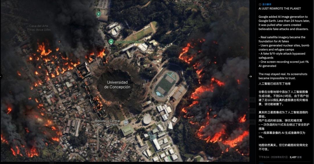
What spreads outside the product is often only the generated result. The real archive remains in Google Earth. No matter how clearly the boundary between reality and fiction is divided inside the map, it cannot guarantee that viewers outside the screenshot can still see this boundary.
Besides, Google Earth is not a neutral map product. News agencies, weather and outdoor enthusiasts, travel lovers and ordinary users all regard it as a public reference system, to confirm whether a building exists, when a certain area changes, and whether a widely circulated photo matches the real landform.
Therefore, AI-generated fake images do not even need to fool everyone. As long as the public knows 1) Google Earth can also generate images, 2) they receive a screenshot from Google Earth, there will be endless disputes. Facing an image of a building or a disaster photo, the first question raised will become "Is this AI-generated?"
The risks brought by generative AI are never just that people believe in false content, but also that people begin to no longer trust real content. By integrating the image generation tool into Google Earth, Google personally added this doubt to the public reference system it has built for 20 years.
Not every AI button is wrong
To be fair, the demands Google designed for this feature are not completely fictional.
Architects do need to put design plans into real plots, and teachers may want students to intuitively see what ancient cities looked like. There is a visualization demand for "what if this place becomes another look" in urban planning, real estate display, history education and home decoration. Nano Banana uses real geographic information to maintain the consistency of proportion and environment, which makes it more suitable for completing these tasks than ordinary image generation tools.
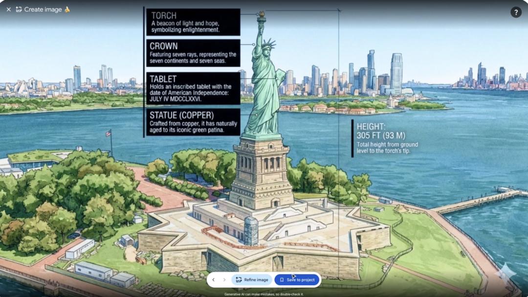
The problem is that all these demands have a common premise: What users want to see is not "what this place is", but "what this place could become". The former is the core commitment of Google Earth, while the latter is an independent creation and simulation tool.
Google could have made it a clearly isolated "Imagination Mode" or planning workbench, marked fictional content with a completely different visual interface, kept prompts on the exported images that are hard to crop off, and set stricter restrictions for military, disaster, conflict and public safety locations. Or it could open the feature to architects, teachers and geography professionals first, observe the real usage, and then decide whether to let all global users "enter anything they want to see".
But the actual release method was more like a model capability demonstration: Nano Banana can already edit photos and generate images, and now it has come to Google Earth.
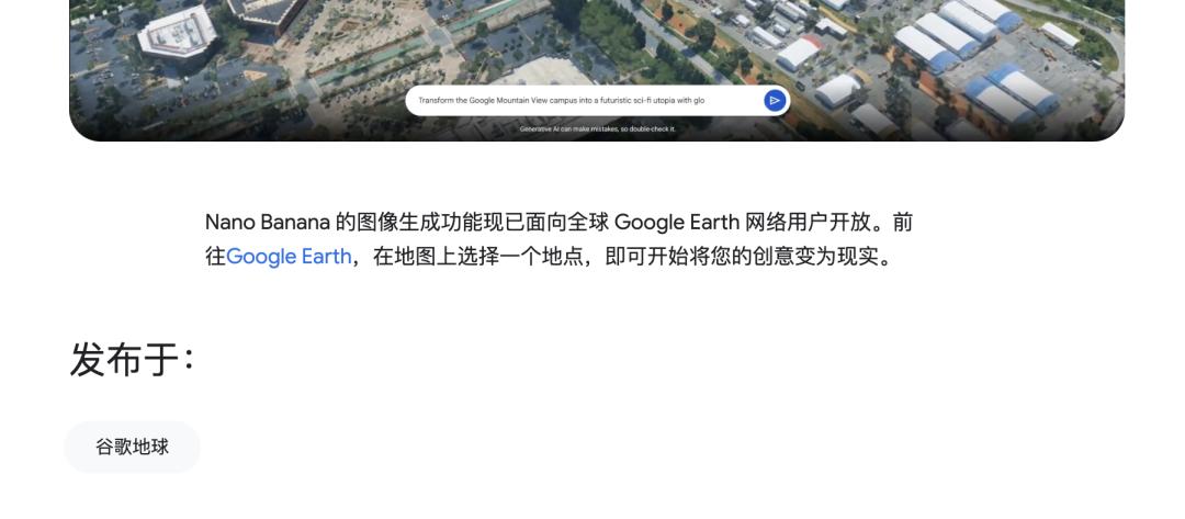
The product was first designed to prove that AI is everywhere. As for whether this capability matches the role of Google Earth, it seems to be left to be verified after launch. As a result, it was a playful person who thought of generating a nuclear power plant that helped Google complete the product test.
When all products start making concessions for AI
This sense of incongruity does not only exist in Google Earth. In the past few years, Google has almost integrated generative AI into every mature product. AI summaries appear at the top of search results, Gmail and Docs help users write and summarize content, Google Photos can reimagine photo content, and Chrome, Messages and various work tools are constantly adding Gemini entrances. Nano Banana has previously entered Search, Photos and Chrome, and now it is Google Earth's turn.
This does not mean that these features are all worthless. Using AI to organize emails, extract key points from long articles, or find a restaurant suitable for a dinner party according to natural language, may be more efficient than the previous operation methods. Google's real advantage is precisely that it owns search, maps, email, photos, browsers and operating systems, which allows the model to access real tasks, instead of being trapped in the chat box.
But there are different trust contracts between different products and users. When users open Google Earth, their first expectation is not imagination, but reality.
When "adding AI" becomes a unified corporate goal, these differences are easily smoothed out. The model team sees the same capability: understanding instructions, generating text, and modifying images; what the product team should have asked is another set of questions: why do users come here? What do they take for granted as the truth? Will this button enhance the core value of the product, or directly consume it?
Google spent 20 years making Google Earth a place where people confirm the real world